Researchers from the USGS, as part of the Pacific Coast Fog Project, produced some really cool fog maps: http://onlinelibrary.wiley.com/doi/10.1002/2015EA000119/full
These maps show the coastal fog zone as fog and low cloud contours. The contours represent the average number of hours of fog and low clouds/day during the summer months. These maps have been extremely helpful in locating fog lichen occurrences farther inland than expected. The maps clearly show where fog flows inland through gaps in the topography, like the Petaluma Gap and Golden Gate. We can now target our fog lichen mapping effort in these inland foggy areas.
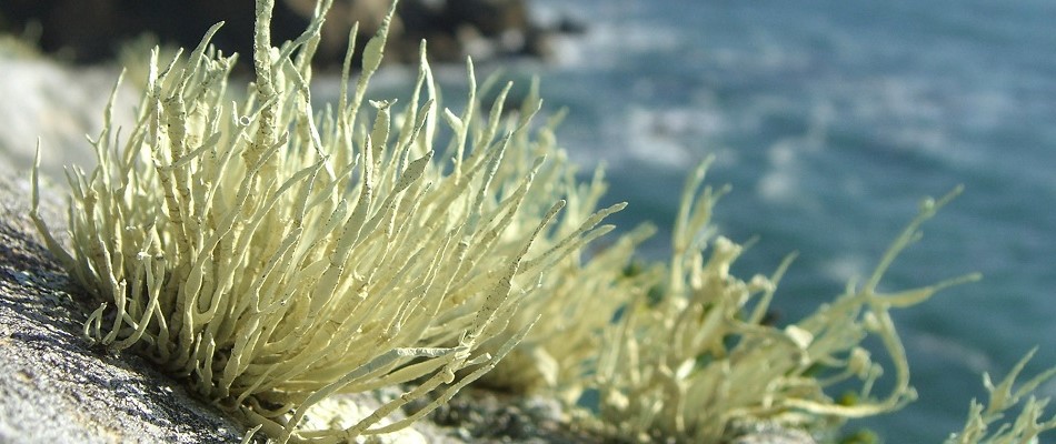
Pilot data from the fog lichen study show that Niebla homalea abundance is positively correlated with amount of summer fog and nearly all of the mapped occurrences of this species are from areas with more than four hours of fog/day in the ...more ↓
Researchers from the USGS, as part of the Pacific Coast Fog Project, produced some really cool fog maps: http://onlinelibrary.wiley.com/doi/10.1002/2015EA000119/full
These maps show the coastal fog zone as fog and low cloud contours. The contours represent the average number of hours of fog and low clouds/day during the summer months. These maps have been extremely helpful in locating fog lichen occurrences farther inland than expected. The maps clearly show where fog flows inland through gaps in the topography, like the Petaluma Gap and Golden Gate. We can now target our fog lichen mapping effort in these inland foggy areas.
Pilot data from the fog lichen study show that Niebla homalea abundance is positively correlated with amount of summer fog and nearly all of the mapped occurrences of this species are from areas with more than four hours of fog/day in the summer. So, check out the fog maps and get out there to see if you can find fog lichens in inland foggy areas or areas with 4 or less hours of fog.
****Please let me know if you search inland rocky outcrops and don't find any fog lichens. We don't have a way in iNat to log negative searches, so you can leave a comment on this post and I'll keep a map of these negative searches.
Happy hunting,
S. Benson
less ↑