Meditating on Mussel Beds
These last few weeks we've been thinking about mussel beds. How best to monitor them in the intertidal? With the competing forces of being released from their main predators, Pisaster ochraceus (ochre stars), yet people freely harvesting them at Pillar Point, it's important to get a sense of what's going on. Are the lower edges of mussel beds expanding because the sea stars aren't there to eat them? Or overall are mussel beds at Pillar Point shrinking, due to harvesting? Mussel beds are notoriously difficult to get an accurate measurement of area by hand, thanks to their strange shapes, often with holes in the middle. I mean, we could do it, but it certainly wouldn't be fun. Or easy.
So we've tried out some different approaches over the past few weeks:
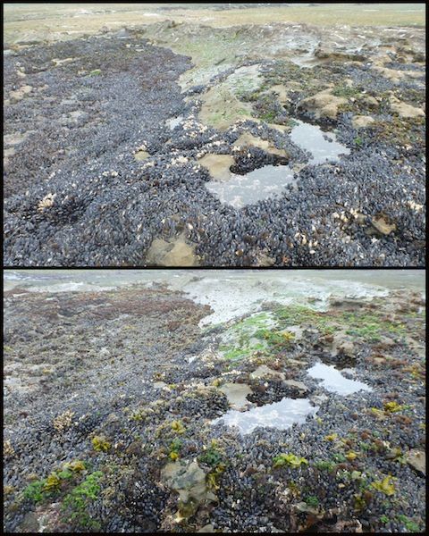
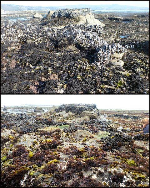
1) Re-taking photos of mussel beds from the ground. Through our citizen science work, we've happened to take photos of mussel beds while exploring the reef. Some of those photos are from 1.5 - 2 years ago, so we thought we should try to re-locate where some of those photos were taken, and try to photograph the mussel bed again from the same angle, so we could compare photos. Here are a couple examples (in each pair, the top photo is the old one, the bottom photo is new):

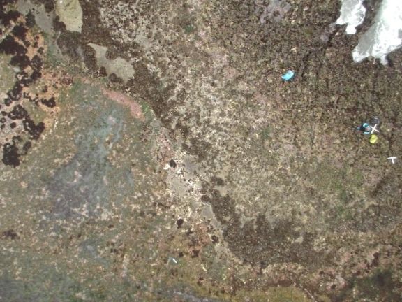
2) Monitor mussel beds by photographing them via kite, then stitching the photos together and using GIS to map mussel beds. Here's a photo from our most recent kite-deployment (note the mussel beds running diagonally through the photo):

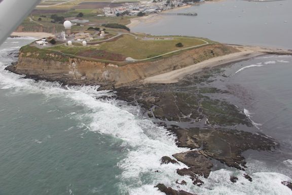
3) Take an even more elevated view, and photograph mussel beds via small plane! Here's Pillar Point reef from the air:

We still need to go through our photos from these three different methods to see what we can learn. Visually, they're all really interesting! But hopefully one or more of these protocols can help us better understand what's happening with mussel beds at Pillar Point.


Comments
Hi Alison,
In what intertidal "zone" would you say are the mussels in photos three and four are located?
A reviewer of my survey at Fitzgerald, posted at
https://intertidalsurvey.wordpress.com/2014/06/08/fitzgerald-marine-reserve-survey-report-april-7-2014/,
questioned my observation in April 2014 of the location of mussels in Zone 1, as they are firmly established as an indicator species for Zone 3.
Your photos are similar to what I observed and seem to show the mussel beds very high in the intertidal.
James
Hi James (@james11),
Yes, FMR and Pillar Point are somewhat similar in their topography of being a mostly flat reef with some elevated rocks throughout, and we do usually find mussels on these rocks. I think, though, that I wouldn't call these rocks "zone 1" in the true sense, because they're not actually up near the shoreline, where the reef meets the sand/cliffs. We find these rocks with mussels much closer to the "outer edge" of the reef, where they're obviously getting a lot of wave action and are getting wet early on as the tide comes back in.
I think a lot of the traditional illustrations of zonation rely a lot on elevation - that you're literally going downhill as you move from the shoreline to the subtidal. That's just not what we see in this section of the coast, and since zonation is truly about emersion/immersion and other stressors (both physical and biological), in some cases you have to rely on the organisms you see to let you know what zone you're in. So even though these rocks on the reef are high points, because they're out near the edge of the reef and subject to wave action and early wetting/inundation as the tide comes in, I would still consider the band of mussels an indication that this is somewhere in a zone 3/mid-intertidal area.
On some of the truly tall rocks out at the edge of Pillar Point (Sail Rock, for example), I think you could say there are zones 1-4 from the top of the rock down to the base - simply because it's tall enough that even during high tide, the top is still out of the water, and those organisms are really just getting spray/splash as their primary form of wetness (a characteristic of zone 1/the supralittoral zone). Not so for these shorter rocks in the photos - during high tide they're definitely all the way submerged, and knowing the mussel beds at FMR, I'd say the same for those rocks - the mussels just couldn't survive if they were only getting wave spray.
Just my thoughts - I'm certainly not an expert in zonation, but I do think it's important to consider where on the reef these mussel bed rocks are - near the shore vs. closer to the outer edge of the reef.
I hope that's helpful!
Alison
Thank you Alison.
Add a Comment