Help Radnor to River map Nashville’s forests! Your data will be linked with satellite images to calibrate a county-wide forest map for conservation and land-use planning. Please follow the guidelines below (and visit www.Radnor2River.org for more background).
Your task is to find forested locations, or “sites,” and decide whether each site is heavily invaded by non-native species or whether it is relatively invasive-free. (See the project list for some common invasives). To be included in the project, upon recording an observation, please answer the two questions in iNaturalist about whether the site is invaded and how heavily it is invaded, and keep your geoprivacy open so that locations are recorded - precise/accurate locations are important here. Also, sites should be visited between April 1 and December 1.
For every “invaded site” try to also find an “un-invaded site,” so that you have roughly equal numbers of both types. The person with the most number of paired invaded/un-invaded sites by the end of the project wins!
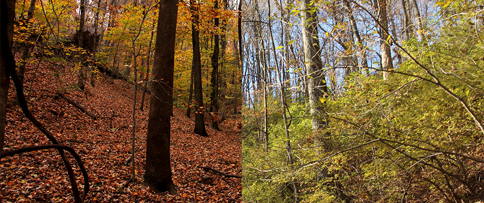
You can think of each site as a square, approximately 100 feet (30 yards) wide, within the forest. To count, each site should be inside of a closed-canopy forest, at least 100 feet (30 yards) from the forest edge, and at least 300 feet (100 yards) from any other site.
When you locate a site, record observations in iNaturalist of any invasive species you find, record observations of at least one native species, and also take six “habitat photos” standing near the site center and looking approximately in each cardinal direction (N,E,S,W), as well as up & down, which you can append to any of the single observations at that site. The goal of these habitat photos is to capture the quality of the forest – both how the trees look and how the shrubs look. As a bonus, if you could record observations of each canopy tree species, that could be helpful in future analyses, but not necessary for this one.
less ↑