Intertidal Biodiversity Survey at Pillar Point's Journal

Journal archives for April 2015

April 9, 2015

April 2015 update

April 8, 2015

Today's field day heralded the return of some upwelling to our coast - seen in the clarity of the water, and certainly felt in the coldness of it as well! We're hoping it continues.

 photo 2015.04.08 Pillar Point_zpsklzducgu.jpg

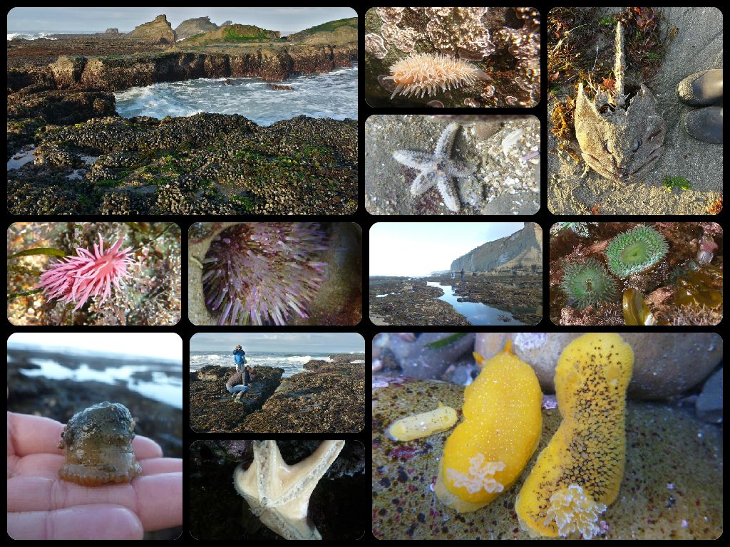
The Hopkin's Rose, Okenia rosacea was still seen in large numbers. Many Hermissenda crassicornis were visible as well - lots of them swimming upside down on the surface-tension of the water.

A handful of larger adult Pisaster ochraceus were out, and we also spotted some tiny juveniles. We're still waiting for Pycnopodia helianthoides, the sunflower star, to return to the intertidal, and we've only seen one pink star, Pisaster brevispinus, over the last year or so - and not very many giant sea stars (Pisaster giganteus) either.

To add to the day's excitement, we found a little Northern elephant seal pup hanging out on the "dog beach" as we were walking back to the parking lot. It didn't seem to be doing so well, so we called the Marine Mammal Center, and got to see part of the rescue. The pup was given the name "Jake," so we should be able to track it on the MMC's patient list.

Since the project's launch in June 2012, our citizen scientists have made over 4000 observations, and have documented more than 400 species, building an impressive baseline species list for Pillar Point!

Posted on April 9, 2015 12:06 AM by kestrel kestrel | 0 comments | Leave a comment

April 28, 2015

Meditating on Mussel Beds

These last few weeks we've been thinking about mussel beds. How best to monitor them in the intertidal? With the competing forces of being released from their main predators, Pisaster ochraceus (ochre stars), yet people freely harvesting them at Pillar Point, it's important to get a sense of what's going on. Are the lower edges of mussel beds expanding because the sea stars aren't there to eat them? Or overall are mussel beds at Pillar Point shrinking, due to harvesting? Mussel beds are notoriously difficult to get an accurate measurement of area by hand, thanks to their strange shapes, often with holes in the middle. I mean, we could do it, but it certainly wouldn't be fun. Or easy.

So we've tried out some different approaches over the past few weeks:
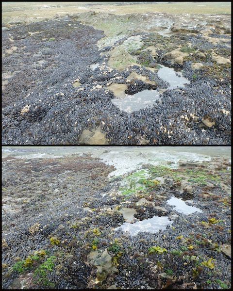
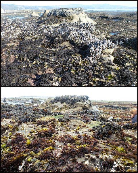
1) Re-taking photos of mussel beds from the ground. Through our citizen science work, we've happened to take photos of mussel beds while exploring the reef. Some of those photos are from 1.5 - 2 years ago, so we thought we should try to re-locate where some of those photos were taken, and try to photograph the mussel bed again from the same angle, so we could compare photos. Here are a couple examples (in each pair, the top photo is the old one, the bottom photo is new):
 photo Mussel 3_zpsjfnbzibz.jpg

 photo Mussel 7_zps04sydzw4.jpg

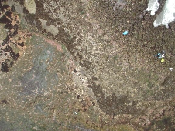
2) Monitor mussel beds by photographing them via kite, then stitching the photos together and using GIS to map mussel beds. Here's a photo from our most recent kite-deployment (note the mussel beds running diagonally through the photo):
 photo ca9c3cdc-be89-4f92-afdd-e0af80e27964_zpshwejcn3r.jpg


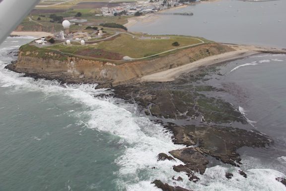
3) Take an even more elevated view, and photograph mussel beds via small plane! Here's Pillar Point reef from the air:
 photo PillarPtIMG_2238_zpsks1p583s.jpg

We still need to go through our photos from these three different methods to see what we can learn. Visually, they're all really interesting! But hopefully one or more of these protocols can help us better understand what's happening with mussel beds at Pillar Point.

Posted on April 28, 2015 09:47 PM by kestrel kestrel | 3 comments | Leave a comment